Guiyang Nanming engineering monitoring Co., Ltd.
Contact: Rao manager 18908518099
Seat machine: 0851-86822621
Fax: 0851-86822621
Mailbox: nmgcjc@vip.163.com
Web site: www.nmgcjc.com
Address: No. 109, Zhonghua North Road, Yunyan District, Guiyang, Guizhou (No. 1802 of Zhongxia building)
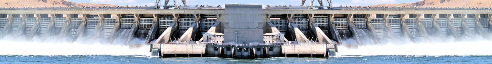
Quality test content and experimental method of water conservancy and hydropower project
Introduction to "measurement class": the quality of water conservancy and hydropower projects is related to the safety and safety of people's lives and property, and the development of the national economy and social stability. It is related to the development of the life and benefits of the project, and to ensure the quality of water conservancy and hydropower engineering construction is of great significance. Engineering quality test is the key technology in the system to ensure the quality of water conservancy and hydropower project, is an important means of quality supervision and supervision, inspection result is to improve the quality of the basis, is the assessment of engineering quality, engineering safety evaluation and identification, project acceptance basis, but also the quality of judgment and quality accident treatment basis. Especially in the evaluation of the difficult and perilous project identification and emergency treatment, engineering quality inspection work plays an irreplaceable important role. Such as the reinforcement of dangerous reservoirs in recent years in the country to carry out the correct evaluation of engineering quality grade and dangerous reinforcement, in this year's Wenchuan earthquake earthquake relief of emergency earthquake damaged water conservancy projects properly, have benefited from the project quality testing provides the test data and scientific evaluation important. In actual work, engineering quality inspection plays a key role in effectively improving the safety operation guarantee rate of water conservancy projects and maximizing the protection of people's life and property safety.
Engineering quality testing is scientific, impartial, timeliness and law enforcement.
The water measurement is divided into two parts: Measurement and monitoring. The measurement part includes control survey, construction survey and completion survey. The monitoring part includes: safety monitoring overview, external deformation monitoring, internal deformation monitoring, seepage monitoring and so on.
The measurement includes: control measurement, construction survey and completion survey.
The control measure is the foundation and basis of the measurement, check for water conservancy and Hydropower Engineering building completed to provide precision base points and baselines, and the completion of basic surveying and mapping map control, building deformation and displacement, equipment installation and control points of operation and management and provide reference monitoring in construction process. The control measurement has the function of controlling the overall situation, which can limit the transfer and accumulation of the error. The control measurement can be divided into plane control measurement and elevation control measurement. The method of controlling measurement can be divided into conventional control measurement and modern control measurement. The conventional plane control measurement is mainly trigonometric survey, traverse survey, forward intersection, resection and so on. The conventional Gao Cheng control survey is mainly leveling, triangle Gao Cheng measurement and so on. The modern control measurement is mainly the GPS plane control measurement and the GPS height control measurement. Horizontal control survey method including GPS measurement, wire measurement, triangulation measurement, network measurement, network side edges, the GPS measurement technology with high precision, short observation time, high efficiency, all-weather operation, simple operation and other characteristics can be widely used in measurement and control of water conservancy and Hydropower engineering. The method of height control measurement mainly includes three kinds of leveling, photoelectric distance measuring trigonometric leveling and GPS elevation measurement. When laying the vertical control network for water conservancy and hydropower projects, the preferred method is leveling, because it can meet the accuracy requirements of various levels of height control survey. The instruments and equipment for control measurement include optical theodolite, electromagnetic range finder, electronic total station, measuring robot, ordinary optical level and electronic level.
The construction survey is based on the design requirements, the plane location, longitudinal and horizontal axis, geometric size and elevation of the buildings, which are designed on the drawings, are calibrated in the field as the basis for construction. At present, the most frequent and most commonly used instrument and equipment in the construction survey are the total station (with the prism). The construction survey mainly includes the survey work in the excavation work, as well as the measurement work in the excavation of the cavern, the filling of earth and stone, the pouring of concrete, the installation of metal structure, and the installation of mechanical and electrical works. The measurement in the excavation project includes the measurement control in the excavation, the construction layout in the excavation and the measurement in the excavation. In the excavation of the construction process, using the method of elevation layout: leveling method, total station instrument without high operating method; method of point lofting: distance intersection method, angle intersection method of total station polar coordinate method and direct coordinate method (GPS RTK method) the instrument used equipment with Theodolite Level and total station. The measurement in the excavation of the cavern includes ground control measurement and underground control measurement. The ground plane control measurement of tunnel excavation can be carried out by precision traversing, triangulation and GPS global satellite positioning technology. The ground elevation control measurement can be measured by precision leveling or photoelectric distance measuring trigonometric leveling. The underground control measurement generally uses traversing, leveling and photoelectric distance measuring trigonometric leveling. The main task of excavation construction survey is: to determine the direction of the heading face of the tunnel construction and the vertical plane, namely the cavern axis determination and excavation surface (commonly known as the face) to determine the size of the excavation section after excavation; inspection; excavation schedule inspection; excavation quantity period completed. Completion measurements should be carried out after the end of the excavation. Because of its particularity, some special instruments and equipments will be used in the process of cavern excavation, including optical plummet, gyro theodolite, laser directing instrument and tunnel section apparatus. The measurement work in earth and rock fill works includes three aspects: control survey, construction survey and completion survey; the contents of construction survey include measurement of filling foundation (topography and section method) and filling engineering.
Completion measurements can be divided into completion measurements during the construction process and completion measurements after all completion of the completion of the project. The completed survey data and drawing data formed by the completion survey are one of the basic criteria for evaluating and analyzing the quality of the project. The main contents of the completed survey are as follows:
0. 1 the general plan for the completion of the construction of water conservancy and hydropower projects;
2. The main body of the water conservancy and hydropower project is excavated, the base plane is built, the elevation plane position map and the vertical and horizontal section map that is required to be measured according to the technical requirements (the filing scale is generally 1:200).
3. Completion and vertical section drawings and data data at the same location of key parts and design drawings of water conservancy and hydropower projects.
4, tunnel, underground engineering, underground powerhouse excavation section and the completion of the surge shaft lining or anchor (lining section) after the completion of cross section and data;
0. 5 the form and data of the hidden and overcurrent buildings in water conservancy and hydropower projects;
0. 6 mapping and mapping of deformation monitoring equipment after the installation and installation of the completion map and its data;
0. 7 surveying and mapping of the completion of the installation of metal structures and the installation of mechanical and electrical equipment and their acceptance data.
8. Other places to be completed for survey, such as slope anchor cable, anti slide pile, completion plan of permanent accessory facilities in attached construction projects, and important pipeline plan.
For water conservancy and hydropower projects, there are requirements for completion survey as follows: Earth and stone works, concrete works, linear engineering, underwater topographic survey, vertical and horizontal section of reservoir, metal structure and mechanical and electrical installation works.
The monitoring section includes the summary of safety monitoring, external deformation monitoring, internal deformation monitoring, seepage monitoring and so on. The main purpose of engineering safety monitoring can be summed up as follows: three points:
0. 1 monitoring the engineering state changes in operation and monitoring the safety of the project.
0 2 according to the observation data during the construction period, the actual state of the engineering and foundation is grasps, according to which the construction is guided, and the design or technical plan is modified and perfected.
0 3 the monitoring data are fed back to the design to check the correctness of the design and improve the level of the engineering design. The safety monitoring objects of water conservancy and hydropower projects mainly include water retaining structures, slopes and underground caverns. The monitoring projects usually have deformation, seepage, stress and strain, pressure, temperature, environmental quantity, vibration response, and the hydraulic monitoring of the earthquake and discharge building. There are two kinds of monitoring methods: manual inspection and instrument monitoring. Monitoring instruments are mainly sensors, and sensors can be divided into differential resistance sensors, vibrating wire sensors, potentiometer sensors and capacitive sensors according to their working principles.
The external deformation monitoring mainly involves three aspects: the acquisition of deformation information, the analysis and interpretation of the deformation information, and the deformation prediction.
The main methods of external deformation monitoring are as follows:
Collimation method, introducing line method, laser collimation method, vertical line method, precision wire and forward intersection method, 1 horizontal displacement monitoring;
0. 2 the geometric leveling method and the hydrostatic leveling method for the vertical displacement monitoring.
0 3 the polar coordinate method, distance rendezvous method and GPS method for three-dimensional displacement monitoring. The external deformation monitoring work mainly includes the following contents: monitoring horizontal displacement monitoring (reference line method and geodetic method), vertical displacement monitoring (geometric leveling method, trigonometric leveling method and liquid static leveling etc.), deflection detection, crack monitoring of landslide and collapse monitoring.
The commonly used instruments and equipment for external deformation monitoring are divided into two main categories, one is special instrument, the other is measuring instrument. Special equipment is mainly aimed at the special device is used, the introduction of line configuration observation device. As for the vertical plumb coordinatograph is Daochui observation, for the introduction of capacitance measuring instrument read line observation. Geodetic instruments are mainly used for plane displacement monitoring and vertical displacement monitoring. Used a total station, level, GPS receiver and other instruments (such as steel).
The internal deformation monitoring mainly refers to the dam body, the dam foundation (shoulder), the slope, the underground cavern and so on, and the deformation monitoring in the rock mass (or deep).
The internal deformation monitoring project mainly includes the following contents:
1. The horizontal, vertical and arbitrary displacement of the dam foundation, shoulder, underground chamber and other rock engineering, the convergence and deformation of the surrounding rock surface of the cavern, and the tilt deformation of foundation and structure. Displacement monitoring usually adopts the inclinometer, multi-point displacement meter, sliding micrometer bedrock deformeter, inclinometer and convergence meter horizontal displacement, vertical displacement and other specific direction or tilt monitoring.
2. The horizontal displacement and vertical displacement of the earth rockfill dam, concrete face rockfill dam (downstream rockfill and anti filter), cofferdam, concrete cut-off wall and embankment, and the deflection and deformation of the panel. Generally, the horizontal deformation monitoring, vertical deformation monitoring and deflection monitoring are usually carried out by using the guide line horizontal displacement meter, the inclinometer, various kinds of layering settlement gauges (water pipe type, electromagnetic type, dry reed pipe type and string type settlement meter), and soil displacement meter. 3. Unidirectional displacement and multi-directional displacement between concrete dam construction joints, joints between concrete and bedrock, peripheral joints of rockfill dam panels, and random cracks in rock mass and concrete engineering. Unidirectional and multidirectional slit meter, fracture meter (internal and surface) are usually used for displacement monitoring, including joint opening and shearing dislocation deformation.
The internal deformation monitoring instruments are: the inclinometer class (slip inclinometer, fixed inclinometer, beam inclinometer, inclinometer), multi-point displacement meter, sliding micrometer, convergence meter, meter, instrument type of bedrock deformation settlement (pipe type, electromagnetic type, reed switch and string type settlement gauge), wire type displacement meter, displacement meter, joint meter.
Seepage monitoring is a necessary project for safety monitoring of water conservancy and hydropower projects, usually including seepage, pore water pressure, seepage flow and water quality analysis. Seepage monitoring includes: monitoring of dam and dam foundation seepage, monitoring of seepage around dam, monitoring of groundwater level on slope and near reservoir bank, monitoring of seepage condition and external water pressure of underground cofferdam. The main equipment for seepage monitoring is the pressure measuring tube and the electric measuring water level meter.